
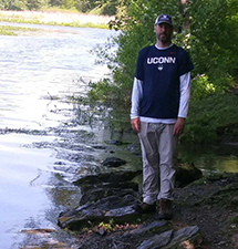
This is what 268 pounds looks like on the editorial director at NorthJerseySports.com.
Sitting on the doctor’s table on February 5, 2019, the numbers 2-6-8, 2-6-8, 2-6-8 were blinking on an endless loop. My doctor was blathering on about something, but all I could focus on was 2-6-8. That was my weight nearly four months ago, a mere 32 pounds south of a number I wanted no part of.
Time moves fast and for the last 20 years I have been laser focused on building northjerseysports.com and raising a family, which put physical activity on the back burner. But then 2-6-8 happened and, almost immediately, I laced up the old hiking boots and got walking. I have not stopped since and it has spurred my new addiction.
Now, I walk. Every day since February 6 I have hoofed at least 10,000 steps and most days it is between 15,000 and 25,000 steps in a 24-hour period depending on how many I can fit my schedule.
That has led to this feature on northjerseysports.com We are calling it ‘Down The Trail,’ and the idea is to (besides filling space) cover some ground with an occasional series that is quasi-sports related while we wait for games to start again . Down The Trail is brought to you by The Anvil, a state-of-the-art sports performance center in Fair Lawn.
Because northjerseysports.com is like a baby that constantly needs feeding, most of my steps early steps were taken on the pavement of Northvale, New Jersey, home to the world headquarters of 4-Feet Grafix, and then over the border in Southern Rockland County, NY, but as my addiction as grown, so my steps have taken me farther afield.
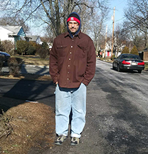
February 6, 2019: The first walk.
In my college days at East Stroudsburg University we did some hard-core hiking on the Appalachian Trail and in and around the Delaware Water Gap. Back then we did not call it exercise, it was more like a chance to haul some full coolers into the woods one day and drag them out empty a few days later.
Now, as an old guy, I will revisit some of the old haunts and try to find some new ones and share whatever I come up with. Got any ideas for a hike worth taking? Email me here.
Any other hiking tidbits (gear worth buying, maps worth having, etc.) to share? Hit me on the twitter @NJScom.
Wanna take a walk? A lot of people I have talked to on my rounds through North Jersey athletic venues have threatened to join me, so…Let’s do it!
Below I will update where I am heading next and where I have been.
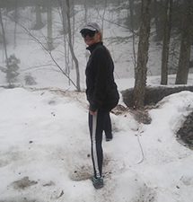
Ah, yes...Vermont in April.
IN THE HOPPER:
CAMEL’S HUMP: This is the one I have been most looking forward to since re-lacing the boots. My daughter, an environmental science major at the University of Vermont, has already completed this one and I have seen the pictures.
My wife and I actually tried to access the route back in April, but again, the learning curve is as steep as the hills. April on a mountain in Vermont is similar in climate to mid-January in Northvale, so we got a picture in the parking lot and got the heck out of there.
The Vermont Brewfest is also on the upcoming calendar, so the hope is to consume quality craft beer one day and hike it off the next on Vermont’s third highest mountain.
PAST ADVENTURES (from most recent):
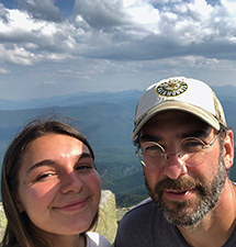
The summit of Whiteface Mountain with a former NV/Old Tappan bowling team captain.
ADIRONDACK PARK: There is nothing that screams American like July 4th in Lake Placid, NY, home to two Olympic Games (1932 & 1980). I have been that far north on the east side of Lake Champlain many times, but never on the New York side and what a trip. The first hike was disguised as a game of disc golf at the base of Whiteface Mountain, the site of the downhill ski races for both Olympiads.
That patriarch of the Doviak Clan was the winner by five strokes over his nearest competitor, but the course carved into the side of an Olympic venue with an elevation of 4,865 feet counts (at least in my book) as a genuine hike.
The Northern Adirondacks are a hiker’s paradise. It’s pretty remote, but it is hard to get a parking spot at a trailhead if you arrive after, say, 9:00 a.m. It’s a different kind of traffic when you are cruising a back road with few structures in sight and then, blam, you are trying to parallel park into the last spot on the shoulder of said country highway. Becoming a Saranac 6er brings in a fair load of those looking to hoof the hills and Mount Marcy, the highest of all the Adirondack Peaks at 5,344 feet, is a huge draw as are all of the so-called High Peaks.
My goals were more modest, to say the least. My travel partner and I went up Cobble Hill, a fun little 2-plus mile out-and-back trail that we hit early in the morning while the two youngest members of our group were still snoozing. There was one part where it was necessary to use a rope to scale a smooth-faced rock, the most technical climbing I have done since about 1993 or so.
The next steps we took were at a true tourist’s destination called Ausable Chasm, a kitchy roadside attraction that was big in the 50s and 60s when it was not so easy to travel far and wide. The Northern Adirondacks were about as far as a middle class family could get back in the day (at least so I am told) and Ausable Chasm bumper stickers were as plentiful in the middle of the 20th century as South of The Border bumper stickers were for my generation growing up in the 70s and 80s.
Ausable Chasm is hiking lite. The trails are not paved, but they are maintained and manicured and every half a mile or so a vending machine pops up where you can replenish any fluids lost (which would have come in handy if you choose to continue reading about my Harriman State Park misadventure). There is also a short float on a raft down the Ausable River before the walk/hike back to the clubhouse.
By far the highlight of the trip for me was the sojourn to the top of Whiteface, but most of that was done in the driver’s seat of the NorthJerseySports.com Pace Car, a 2015 Fiat 500L. In 1929 as governor of New York, Franklin D. Roosevelt commissioned the building of Veteran’s Memorial Highway, which switchbacks its way close to the summit. He returned as president of the United States in 1936 to cut the ribbon as the road was opened to the public.
Roosevelt gave the following dedication, “This is a tribute from the citizens of the state of New York which would be appreciated by those fallen comrades of ours who served their state and their nation so well. It is fitting that we should dedicate it in their names. It will stand as a tribute to them through all the centuries to come."
While driving is certainly not hiking, there is some work left to do to get to the summit. One-fifth of a mile is reserved for a walk and then semi rock scramble, which puts you on top of the hill from where you can see forever. On a clear day the line of sight can reach 120 miles, which includes a commanding view of Lake Placid, both the town and the body of water. If the conditions are right, you can see all the way to Montreal and beyond.
HARRIMAN STATE PARK: This one was a miss for a different reason…bugs. The first week of July in the woods on the banks of Lake Skannatati is apparently high time for large black bugs that dive-bomb would-be hikers. My wife and I got about a mile in before we turned around at the large rock called Time Square, which is at the confluence of a bunch of trails in the Harriman system. The loop was to include a visit to the old Hasenclever Mine, but we gave up the hunt. This hike is to be continued…
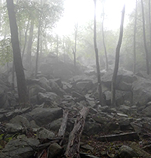
The conditions on the trail on the day I got lost.
HARRIMAN STATE PARK (3X): I thought this new iteration of an old hobby was going to be easy. Lose some weight, tie the boots up tight, get in the woods and then walk back out again. Well…Harriman State Park had other ideas one cloudy Thursday in late June. I am taking this seriously, which means I am researching trails, bringing the proper supplies, being hyper aware of time and distance and getting going early in the day to give myself maximum daylight just in case the plan goes awry.
But even still, I am a rookie and my first mistake cost me. The goal was to follow the Ramapo-Dunderberg trail (red dot on white background) to Cat’s Elbow, a cool lookout point, then continue to where it hooks up with the Timp Torne Trail (Blue blazes), which I was supposed to follow to the Appalachian Trail, make a left, complete the loop in an estimated 3.5 hours. It did not exactly go as planned.
I did a scouting mission on the Tuesday, another overcast day on which the parking lot was empty and the woods just about the same. I missed the turn from the hike-starting bike path to the R-D trail, wound up on the Appalachian Trail about three hours too early. I did a couple of miles there, doubled back, found the turn I missed and resolved to return in two days’ time to get it all figured out.
It was raining lightly that Thursday morning, but I decided to press on. I was into it. I was a journalist back on the AT, the next Bill Bryson, so pumped to have taken some steps on that venerable path that stretches from Georgia to Maine. Ambition, even if it was ambition that nobody but me would even know about, probably got the best of me as I headed for the Anthony Wayne Recreation Center parking lot, again empty, and disembarked for my journey at just after 7:00 a.m.
I was on it. I found the R-D hook-up no problem, made quick work of the sometimes tricky trail and got up to Cat’s Elbow in no time. I was bummed for sure that there was no view out over the Hudson River as promised in the well-written guide book (Circuit Hikes in Harriman by Don Weise), but the upside was the temperature was cool and I continued on the search for the Timp Torne Trail, which was about a mile away.
Oh, about two hours later, blindly following the first sign of blue blazes that I saw at the junction, I realized I was on the Timp Torne Trail all right, but travelling in the wrong direction. That was a sobering realization. Now, instead of being home in time to grab a shower and pick up NorthJerseySports.com editorial assistant Hope K. Doviak from the last day of her sophomore year of high school, I was in the woods by myself, about four hours into what was supposed to be a 3.5 hour hike. And, I was just about out of water; I skipped breakfast, brought nothing to eat and was faced with the decision of turning around or sticking with an unknown trail with the hope that it would lead somewhere useful. With no view of the Hudson and no sun to navigate by, it was a crapshoot.
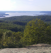
The view from Cat's Elbow on the day I got it right.
I chose option 1, hit reverse and decided to check in with the home base so no one would worry; a laughable thought. “Hey, honey. I am lost in the woods, my cell phone battery is about to die and I think it is going to take me four hours to get out of here and that is if all goes well.”
With the cavalry in pursuit, there were some sketchy moments to say the least, but I did eventually find my way out. What was supposed to be a 5 mile, 210 minute hike turned into what was probably a 16-20 mile, 10 hour odyssey.
Instead of scaring me out of my new hobby, the experience has emboldened me. I realize now that I can handle much more distance and can lean on my wits to get out of a sticky situation. I also was gifted a brand new set of rain-resistant trail maps. That’s the thing…a “sport” that involves little more than walking can quickly devolve into something a bit more dangerous.
Lessons, and there were many of them, learned, I gave myself a full day off and returned on the Saturday to right some wrongs. This time I was on Cat’s Elbow on a beautiful day where I got the vista I was looking for and also made the proper moves through the Timp Pass on my way to completing the loop, which, again, is supposed to take 3.5 hours, in three hours flat.
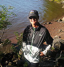
Englewood's finest public school teacher on the banks of the Hudson River.
ALPINE BOAT BASIN, PALISADES INTERSTATE PARK: I could shoehorn this particular trail into any spot here because this has become something of our home track through the woods. There are many different places to start a loop (Alpine Lookout, on the footbridge over the PIP that can be accessed on 9W North, parking by the Interstate Police headquarters or at the bottom of the hill in the boat basin parking lot) and there are challenges no matter where you start or finish a no matter which direction you choose to navigate the loop.
There is the famous rock scramble which leads to Peanut Falls, the rocky path that leads from the police HQ down to the river which can be a bear if going in the upward direction and then there is the gut-buster that lets me know just how far out of shape I still am. Choosing the shore path in a clockwise direction means a nice stroll along the banks of the Hudson River.
It is crazy to be somewhere so close to the madness of NYC and the rat race yet still find the tranquility of deep woods. Anyway, that leads to sign for the Closter Dock Trail, which takes you from the shoreline to the top of the cliffs in the matter of .3 miles or about 600 steps. Oh, it friggin’ hurts. The route switchbacks up the face of the cliff with a variety of footing from straight dirt to stone steps put in place by volunteers. Every step is harder than the last one and every time you think you are at the top, up it goes again.
By the time I get to the wooden bridge that ends the torture, I feel like John Candy after a game of racket ball in the movie Splash (look that one up, too). Panting and sweating is not a good look, but there is no way around it. After regrouping, there is a little uphill section that leads to the Women’s Monument and a great view back over the cliff. Well worth the exertion and a good way to measure the progress of fitness reclaimation.
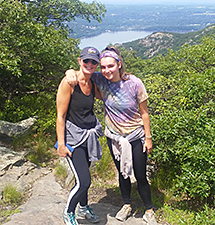
My hiking companions near the apex of the Bull Hill Loop.
BULL HILL FULL LOOP, HUDSON HIGHLANDS (GARRISON, NY): Compared to the one above, this one went off without a hitch. A pretty ride up the Palisades Interstate Parkway, over the Bear Mountain Bridge and then a left gets you there. Just past the village of Cold Spring is the Little Stony Point parking area. A couple of flat steps take you from the car to the trailhead and then it is pretty much all uphill from there.
The whole Hudson Highlands State Park trail system is well maintained and they are working on the Bull Hill trail, which caused a few detours, but nothing could spoil the amazing views out onto the Hudson River. It was a Chamber of Commerce kind of day as far as the weather was concerned.
Three of the four Doviak family members were on the trail for this one and even our one mistake turned out to be a blessing in disguise. We somehow missed the turn back to the parking lot and came out on the main road, but the extra 2,000 steps to the car were pleasantly interrupted by Juanita’s Kitchen, a good Mexican joint in downtown Nelsonville, NY. A couple of empanadas were all the fuel needed for the walk back through Cold Spring.
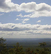
The view from the top of the state of New Jersey.
HIGH POINT MONUMENT: My partner on this journey is my wife and we made our first road trip to a trailhead together to High Point State Park in Sussex County. All Trails says it is a 3.5 mile loop with some tricky spots and rates the Monument Trail Loop as ‘Moderate’ in difficulty. When you get to the monument on top of the hill you are standing on top of New Jersey, 1,800 feet above sea level at the Garden State’s Highest Point (hence the name High Point). Okay, so it ain’t Mount Everest, but remember I am just getting my legs and my lungs back so it was a good place to start.
The ‘moderate’ part of the description was a bit of a stretch. There was nothing too strenuous about the walk, but it was cool, both in terms of temperature and surroundings. We walked up the side of the mountain, came out of the woods on the access road to the monument and then nearly got blown right off the hill by the wind that comes with being on the highest point in a state.
We took some pics at the top, walked down the road until it hooked back up with the Monument Trail and made our way back to the bottom in relatively short order. It was in the parking lot that I got a call from my friend Kevin Sabella informing me that he had secured the athletic director’s job at Ramsey he coveted, then lunch in downtown Port Jervis and then home. A stress free and welcomed re-introduction to the work of trail hiking.
Next maybe I will tackle the highest point in Delaware...Here, I GOOGLED IT FOR YOU.
On the trail that leads to a winery in the woods.
BASHAKILL WILDLIFE MANAGEMENT AREA: This one was a pleasant surprise. Found it through the All Trails app after a visit to our favorite Farm Market (Soon’s Orchard in Goshen, NY), rode through the thriving metropolis of Otisville, NY and then, just on the outskirts of town, we, including northjerseysports.com editorial assistant Hope K. Doviak, dropped anchor in the first parking lot we could find and hit the trail.
This was an easy walk through the woods, a 5.9-mile there-and-back track that follows the Bashakill water system, which is an ecosystem unto itself. It’s marshy in spots, the water runs quick in others, and there is a lookout point about halfway through where you can climb some steps and take in a view. The trail has some soft spots, but that was expected with the soggy spring weather.
About two miles in we came to a parking lot where a retired highway department worker had his high-powered glass trained on an eagle’s nest. He shared his equipment and the knowledge that at the top of the hill just outside the parking lot was the Bashakill Vineyards, which turned our healthy excursion into an enjoyable diversion. Some craft beer, a bottle of red (to take home) and some ice cream later, we were back on the trail in the direction from which we came. We covered about 4.5 out of the nearly six miles and we will be back again on a not too distant weekend day as the winery is only open from 12-6 on Saturdays and Sundays.
TO BUY A COLLECTOR'S PRINT OF THIS STORY PLEASE VISIT 4-FeetGrafix.com.


